


Sunset 1 Voting District, Island County, Washington
About
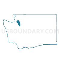
Outline

Summary
| Unique Area Identifier | 684506 |
| Name | Sunset 1 Voting District |
| County | Island County |
| State | Washington |
| Area (square miles) | 2.89 |
| Land Area (square miles) | 1.40 |
| Water Area (square miles) | 1.48 |
| % of Land Area | 48.60 |
| % of Water Area | 51.40 |
| Latitude of the Internal Point | 48.24507430 |
| Longtitude of the Internal Point | -122.52826480 |
Maps


Graphs
Select a template below for downloading or customizing gragh for Sunset 1 Voting District, Island County, Washington


Neighbors
Neighoring Voting District (by Name) Neighboring Voting District on the Map
- Madrona Voting District, Island County, WA
- Maple Grove Voting District, Island County, WA
- Sunset 2 Voting District, Island County, WA
- Utsalady 1 Voting District, Island County, WA
- Utsalady 2 Voting District, Island County, WA
- Water: Saratoga Passage, Island County, WA
- Water: Skagit Bay, Island County, WA